State Map
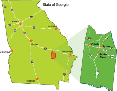 Toombs County enjoys a somewhat central and coastal position in the state surrounded by an excellent network of primary and secondary roads, rail, and proximity to major primary and secondary metropolitan areas.
Less than 90 minutes to the global market access via the port of Savannah as well as BOTH of the two most popular north/south interstate corridors in the eastern half of the country.
Local Area Map
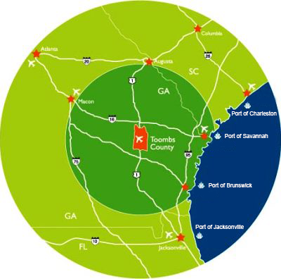 In addition to major metropolitan areas, Toombs County is central and less than a half day transport to – count 'em – four major ports on the eastern seaboard. They are Port of Savannah, Port of Brunswick, Port of Charleston and Port of Jacksonville (Jaxport).
Local Transportation Map
.jpg)
Toombs County's unsurpassed secondary road system puts companies on the road in virtually any major artery's direction in minutes. Rail transport and access to I-16 (north of the county) and SR 23/341 (south of the county) provides less than 90-minute access to 2 global ports.